The Technology Centre of the Region of Murcia (CTCON) has strengthened its mapping and analytical services capability through the incorporation of the Leica BLK360 laser scanner and ArcGIS Pro licence from Esri.
Leica's BLK360 laser scanner is a tool that can be used to scan the enables high-precision 3D data capture in real time. This allows us to collect detailed information on any structure or terrain with millimetre accuracy, which is especially useful for construction, archaeology, heritage and surveying. The BLK360 is very easy to use, which means we can get the job done faster, saving time and reducing costs for our customers.
The ArcGIS Pro licence, on the other hand, allows us to create, edit and share maps with our customers in a more efficient. With ArcGIS Pro, we can create detailed visualisations of geospatial data and analyse the data for valuable insights. In addition, the tool also includes a wealth of editing and analysis tools, which means we can work on any type of project and provide our clients with accurate results.
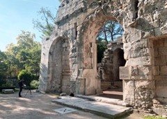
Using both the BLK360 laser scanner and ArcGIS Pro, we can offer a wide range of services to our customers. For example, for construction, we can use the BLK360 laser scanner and ArcGIS Pro. BLK360 for capturing accurate data of the structure before changes or improvements are made, allowing us to analyse changes before they are made. For cultural heritage, we can use BLK360 to create detailed 3D maps, allowing us to have a more complete view of the area.
In addition, with the combination of the BLK360 laser scanner and ArcGIS Pro, we can work on public infrastructure projects, data analysis, urban planning and natural resource management, just to name a few examples. With these tools, the CTCON is ready to help our clients to meet their objectives and make informed decisions based on accurate and high quality data.
Our team of experts can use the tools to to offer precise and customised solutions for our customers' needs. This means that our clients can be confident that their project will be in good hands and that they will receive a high quality service.
If you are interested, please do not hesitate to contact us. Our team of experts will be happy to talk to you and offer you a customised solution to meet your needs.